The Vermont Village That Lived in America While Standing in Canada
When Geography Gets Complicated
Imagine waking up one morning to discover that your house — the same house where you've paid American property taxes, voted in presidential elections, and pledged allegiance to the Stars and Stripes — is actually sitting on foreign soil. Not metaphorically foreign, but literally, legally, cartographically foreign.
That's exactly what happened to the residents of North Troy, Vermont, though it took them 140 years to figure it out.
The Survey That Changed Everything
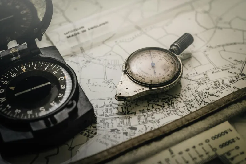
The story begins in 1818, when the United States and Britain needed to settle once and for all where Vermont ended and Canada began. The Treaty of Ghent had ended the War of 1812, but it left some uncomfortable questions about exactly which patches of North American soil belonged to whom.
Enter the surveyors: a team of well-meaning but ultimately fallible men armed with chains, compasses, and an unfortunate tendency toward mathematical errors. Their job was simple enough — draw a line along the 45th parallel north, creating a clean border between the two nations.
What they actually drew was something else entirely.
The Mistake That Nobody Noticed
When the dust settled and the maps were finalized, the small community of North Troy found itself in a peculiar position. The official boundary line, as drawn by those 1818 surveyors, placed their homes, businesses, and farmland squarely within Canadian territory.
But here's where the story gets truly bizarre: nobody seemed to care.
The residents of North Troy continued paying taxes to Vermont. They voted in American elections. Their children attended American schools and grew up reciting the Pledge of Allegiance. The U.S. Postal Service delivered their mail without question. Border guards waved them through checkpoints as American citizens.
Meanwhile, Canadian officials on the other side of the "real" border apparently had bigger fish to fry than worrying about a handful of Americans who were technically squatting on Crown land.
Life in the Twilight Zone
For more than a century, North Troy existed in a legal twilight zone that would make immigration lawyers weep. The community functioned as an entirely American enclave while sitting on what maps quietly acknowledged was Canadian soil.
Residents built their lives around this contradiction without ever really thinking about it. They farmed their land, raised their families, and participated fully in American civic life — all while technically being illegal immigrants in their own country.
The situation created some genuinely head-scratching scenarios. When North Troy residents traveled south to shop in "mainland" Vermont, they were technically crossing an international border. When they drove north to visit actual Canada, they were... well, already there, but also somehow not there.
The Reckoning That Almost Wasn't
The bizarre arrangement might have continued indefinitely if not for the rise of more sophisticated surveying technology in the 1960s. As part of a broader effort to modernize the U.S.-Canada border, officials decided to take another look at that 150-year-old boundary line.
What they found was embarrassing: the 1818 surveyors had been off by several hundred yards in multiple places. North Troy wasn't just slightly misplaced — it was dramatically, undeniably sitting in the wrong country.
But rather than create an international incident over a century-old clerical error, both governments chose the path of quiet diplomacy. In a series of negotiations that somehow managed to stay out of the headlines, American and Canadian officials worked out a solution that was both elegant and slightly ridiculous.
The Fix That Fixed Nothing
Instead of physically moving the border to match reality, or forcing North Troy's residents to choose between countries, officials decided to simply... adjust the maps. The official boundary was quietly redrawn to place North Troy back where everyone had always assumed it belonged: in Vermont.
The correction was so low-key that many residents didn't even realize it had happened. One day they were technically living in Canada while being American citizens, and the next day they were technically living in America while being American citizens. The practical difference was precisely zero.
The Lesson in the Lines
The North Troy border blunder reveals something fascinating about the arbitrary nature of the lines we draw on maps. For 140 years, an entire community proved that national identity has less to do with geographic coordinates and more to do with shared culture, values, and daily practices.
The residents of North Troy were American not because they stood on American soil, but because they lived American lives. They paid American taxes, followed American laws, and participated in American democracy. The fact that their houses happened to sit a few hundred yards north of where cartographers thought they should be turned out to be remarkably irrelevant.
In the end, the story of North Troy isn't really about surveying mistakes or border disputes. It's about the strange, sometimes arbitrary nature of the lines that divide us — and the even stranger human capacity to simply ignore those lines when they don't make sense.
After all, home is where the heart is, not where the surveyor says it should be.